Contact Information

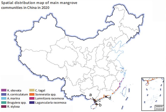
China 10-m spatial distribution of major mangrove species in 2020 (CDMS_10m_2020)
Dataset Overview
The 2020 high spatial resolution products of main mangrove species in China were generated using synthesized Sentinel-2 time-series imagery, high-separability image selection, probabilistic classification, and regional partitioning strategies.Geographical partitioning was conducted based on prior knowledge of main mangrove species distributions, with each region adopting a specific classification scheme. Bi-monthly composites were analyzed to identify periods of highest class separability. A probabilistic Random Forest classification was applied, and pixels with confidence values below 50% were removed through probability stacking. The final mangrove map was refined using Google Earth validation.

Dataset Details
Spatial Resolution:
Time Resolution:
Product Number: CBAS2025-2024Global09
Create Institution: International Research Center of Big Data for Sustainable Development Goals(CBAS);Big Earth Data Center,CAS
Created By: Mingming Jia
Creation Date: 2026-06-06 18:04:27
File Size: 1
Data Format: Geotiff
Type Of Data: 栅格
Data Label:
