Contact Information

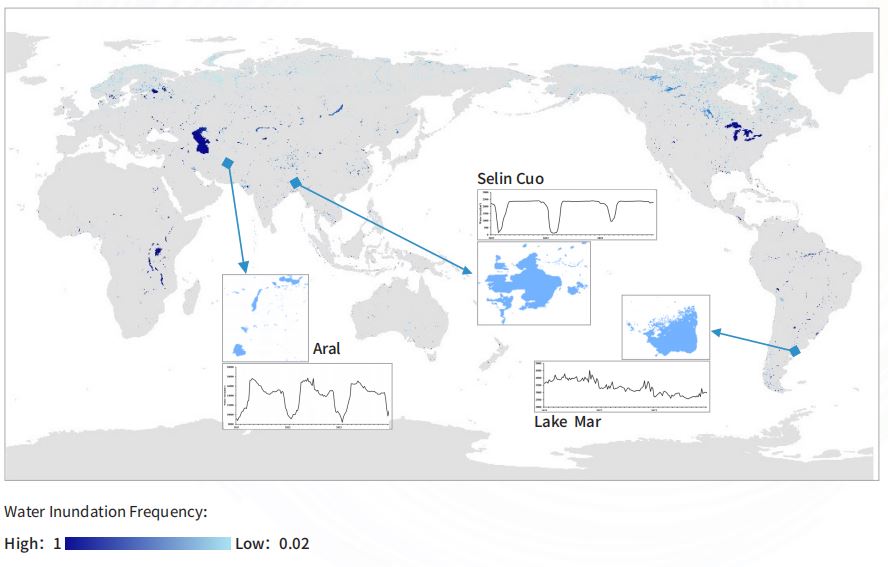
Global Surface Water Dynamic Distribution_250m_2021-2023
Dataset Overview
A global surface water dynamic distribution product with 8-day resolution from 2021 to 2023 developed using MODIS time series satellite data. Using the 8-day NDVI data product synthesized by MODIS, determine the corresponding water segmentation thresholds for each region in a year, and produce primary products of global land surface water distribution; By applying spatiotemporal filtering models and auxiliary data to eliminate the effects of clouds, shadows, ice, snow, and bare soil, a global land surface water dynamic distribution product with 8-day resolution is obtained.

Dataset Details
Spatial Resolution:
Time Resolution:
Product Number: CBAS2025-2024Global05
Create Institution: International Research Center of Big Data for Sustainable Development Goals(CBAS);Big Earth Data Center,CAS
Created By: Qianqian Han ,Zhenguo Niu, Yuhang Jing
Creation Date: 2026-06-06 18:24:23
File Size: 1
Data Format: Geotiff
Type Of Data: 栅格
Data Label:
