Contact Information

Global 30-m burned area spatial distribution product in 2022 (GBA_30m_2022)
Dataset Overview
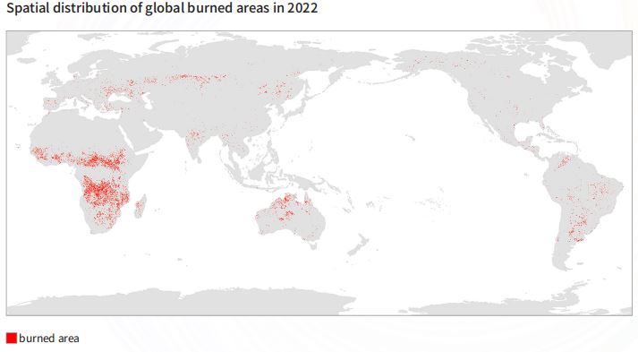
2022 high spatial resolution global burned area products were generated using time series Landsat satellite data, machine learning algorithm, and cloud computing platform.Time series Landsat 8/9 land surface reflectance was employed, and sensitive parameters for burned area extraction were selected, including band (blue, green, red, NIR, SWIR1, and SWIR2) surface reflectance, and several spectral indices, i.e. NRB,NBR2, BAI,MIRBI,NDVI,GEMI,SAVI,and NDMI. Sample database of burned and unburned types was constructed, and 30m resolution global burned area product was generated with the machine learning (random forest) algorithm.

Dataset Details
Spatial Resolution:
Time Resolution:
Product Number: CBAS2025-2024Global07
Create Institution: International Research Center of Big Data for Sustainable Development Goals(CBAS);Big Earth Data Center,CAS
Created By: Zhaoming Zhang, Guojin He, Tengfei Long, Zekun Xu, Shunguo Huang
Creation Date: 2026-06-06 18:07:26
File Size: 1
Data Format: Geotiff
Type Of Data: 栅格
Data Label:
