Contact Information

Global 30-m impervious surface dynamic monitoring product from 1985 to 2023 (GISD_30m_1985-2023)
Dataset Overview
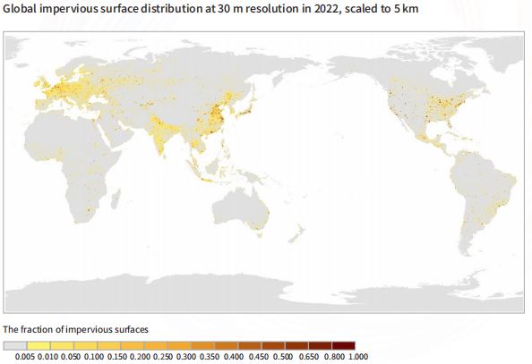
"Impervious surfaces" generally refer to non-natural surfaces that prevent surface water from infiltrating and disrupt the natural evapotranspiration process. They are made of various man-made building materials. These mainly include buildings, roads, parking lots, plazas, and concrete pavements, and they often serve as important indicators for assessing the intensity of human activities and environmental changes. The GISD30 impervious surface products leverage these multi-source prior land-cover data and time-series Landsat observations, aiming to reveal the spatial and temporal changes of global impervious surfaces at 30 m resolution from 1985 to 2023. The GISD30 product uses time-series Landsat surface reflectance imagery to generate multisource "spectral and phenological" features. It combines spectral generation and sample migration strategies to address the challenge of obtaining high-confidence time-series training samples. Additionally, it incorporates local adaptive classification and spatiotemporal optimization algorithms to ensure the spatiotemporal stability of monitoring impervious surfaces. This GISD30 time-series product is developed on a cloud computing platform, utilizing normalization processing. Finally, it employs the random forest classification algorithm and spatiotemporal consistency check model to produce long-term impervious surface dynamic monitoring products.

Dataset Details
Spatial Resolution:
Time Resolution:
Product Number: CBAS2025-2024Global06
Create Institution: International Research Center of Big Data for Sustainable Development Goals(CBAS);Big Earth Data Center,CAS
Created By: Liangyun Liu, Xiao Zhang
Creation Date: 2026-06-06 18:23:00
File Size: 1
Data Format: Geotiff
Type Of Data: 栅格
Data Label:
