Contact Information

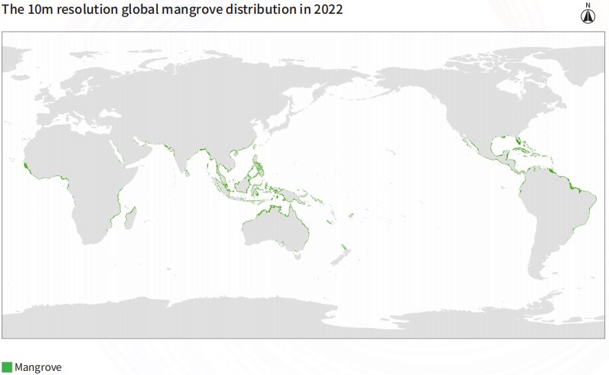
Global 10-m spatial distribution of mangroves in 2022 (GMF_10m_2022)
Dataset Overview
As an important ecosystem component in the tropical subtropical intertidal zone, mangrove forests have a strong carbon sink capacity, rich species diversity, and harbor a large amount of natural resources, which have important ecological and socio-economic values. The10m resolution global mangrove distribution product in 2022 utilizes the 2020 global mangrove distribution data as a baseline, and was obtained through the Otsu algorithm using the 2022 Sentinel-2 data and the GEE cloud platform. The production process of the dataset involved many types of data such as the Sentinel-2 data in 2022, the global mangrove distribution data in 2020. Initially, the global mangrove distribution data in 2020 were used as a baseline, and segmented by continents: Asia, Africa, Oceania, North America, and South America, and a 20m buffer zone was constructed. Then, the Sentinel-2 images were preprocessed by the GEE platform, such as cropping, de-clouding and mosaicing, and mangrove and non-mangrove forests were extracted by continents using the maximum spectral index synthesis algorithm and the Otsu algorithm. Finally, the extracted mangrove forests in each region were vector-synthesized and corrected using sub-meter satellite imagery and the 2020 global mangrove distribution data, to obtain the global 10m resolution global mangrove distribution data in 2022.

Dataset Details
Spatial Resolution:
Time Resolution:
Product Number: CBAS2025-2024Global03
Create Institution: International Research Center of Big Data for Sustainable Development Goals(CBAS);Big Earth Data Center,CAS
Created By: Jingjuan Liao
Creation Date: 2026-06-06 18:26:51
File Size: 1
Data Format: shp
Type Of Data: 矢量
Data Label:
