Contact Information

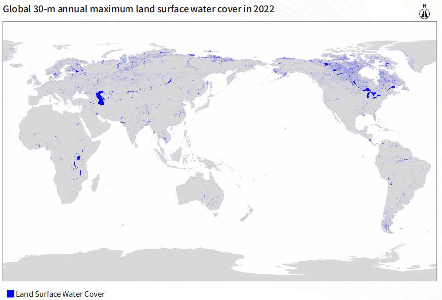
The global annual maximum land surface water cover product (2022,30m resolution)(GAMLSW_30m_2022)
Dataset Overview
The 2022 global annual maximum land surface water cover product, with a spatial resolution of 30 meters, was generated from Landsat satellite data using a prior-knowledge-based rapid extraction algorithm for land surface water. The input data used to produce GAMLSW include Landsat data and Shuttle Radar Topography Mission (SRTM) Digital Elevation Model (DEM) data. Global Multi-resolution Terrain Elevation Data 2010 (GMTED2010) was used in high-latitude areas due to lack of SRTM-DEM data. Firstly, an annual Landsat top-of-atmosphere reflectance dataset was created and cloud masking was applied. Feature indices such as the NDVI, NDWI, and NDSI were calculated, while terrain indices were obtained from the DEM. Subsequently, a set of land surface water extraction rules based on multiple indices thresholds were established using prior knowledge (Liu et al., 2021). Finally, the established land surface water extraction rules were applied to multi-temporal Landsat data of the same region within the annual cycle to extract land surface water information on a per-pixel basis, and the extracted results were synthesized via a spatial logical OR operation to generate the annual maximum land surface water cover product.

Dataset Details
Spatial Resolution:
Time Resolution:
Product Number: CBAS2025-2024Global04
Create Institution: International Research Center of Big Data for Sustainable Development Goals(CBAS);Big Earth Data Center,CAS
Created By: Liu huichan ,He guojin
Creation Date: 2026-06-06 18:25:40
File Size: 1
Data Format: Geotiff
Type Of Data: 栅格
Data Label:
