Contact Information

Desert Locust Monitoring in Morocco, Algeria and Mauritania in 2026/06(Spatial resolution-500m)
Dataset Overview
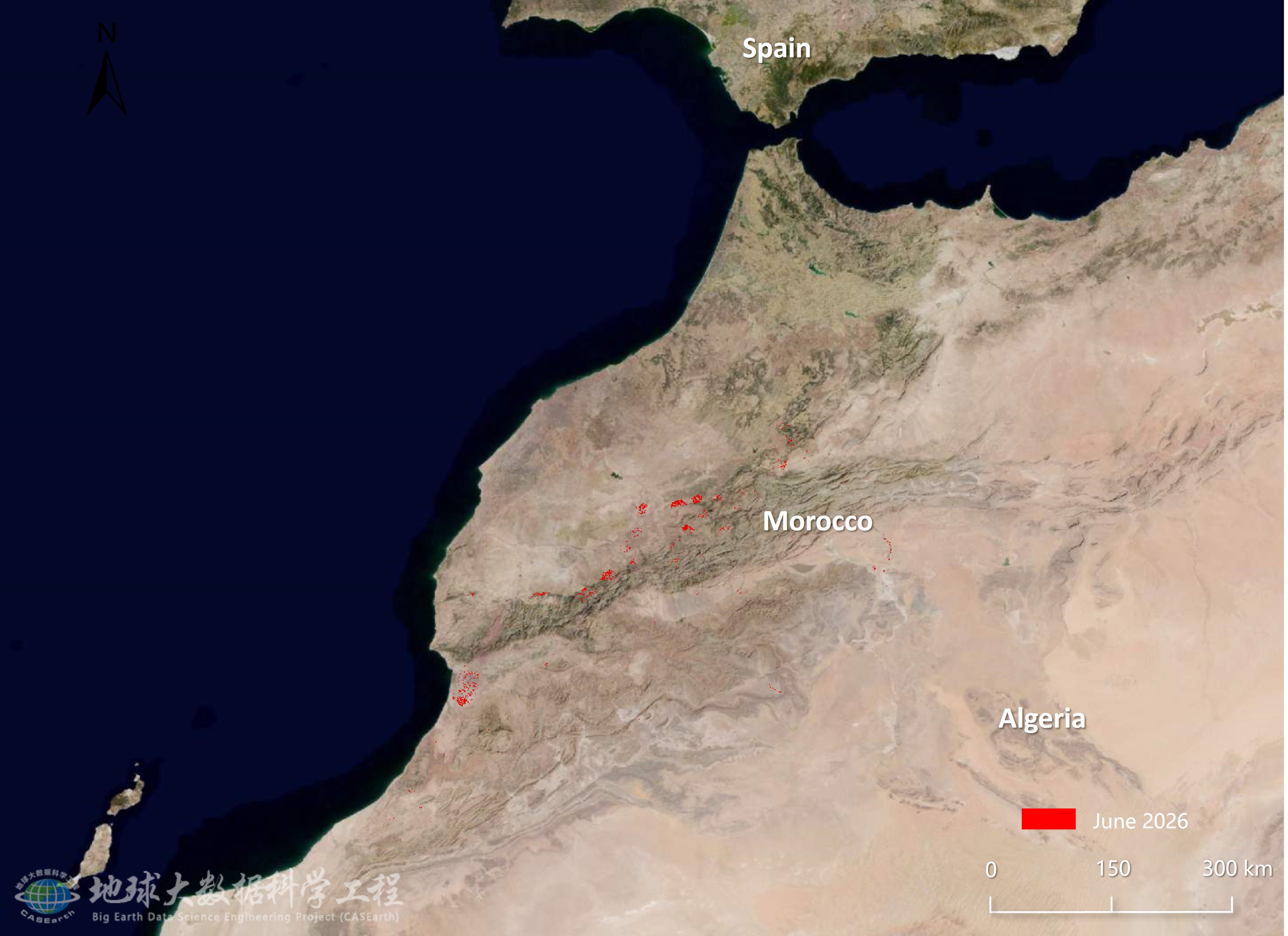
Utilizing US MODIS satellite data integrated with meteorological and field survey data, as well as pest multimodal large models, conducted remote sensing monitoring and assessment research on desert locust disasters in Asia and Africa through intelligent big data analysis and processing. This report focuses on the dynamic monitoring and assessment of desert locust disasters in Morocco, Algeria, and Mauritania. Remote sensing monitoring showed that, in June 2026, desert locusts mainly affected the central-southwestern regions of Morocco, localized western and central areas of Algeria, and southern Mauritania, affecting 104.2, 30.3, and 13.6 thousand hectares of vegetation, respectively. This month, the affected vegetation areas in Morocco and Algeria both increased compared with the previous month, while localized damage was also detected in southern Mauritania. Overall, gregarious spring breeding in Morocco gradually entered its final stage; hopper groups continued to fledge, forming numerous immature adult groups, and some adults dispersed eastward and southward. In Algeria and Mauritania, locust activity was dominated by low-density scattered populations, with localized groups. As green vegetation established earlier in Morocco gradually dried out, available food resources and habitat patches became increasingly fragmented, raising the likelihood of adult concentration and dispersal among the remaining green patches.

Dataset Details
Spatial Resolution:
Time Resolution:
Product Number: XDA19080304282
Create Institution: International Research Center of Big Data for Sustainable Development Goals(CBAS);Big Earth Data Center,CAS
Created By: Yingying Dong
Creation Date: 2026-09-20 10:08:47
File Size: 1
Data Format: Geotiff
Type Of Data: 栅格
Data Label:
