Contact Information

Desert Locust Monitoring in Morocco, Algeria and Saudi Arabia in 2026/03(Spatial resolution-500m)
Dataset Overview
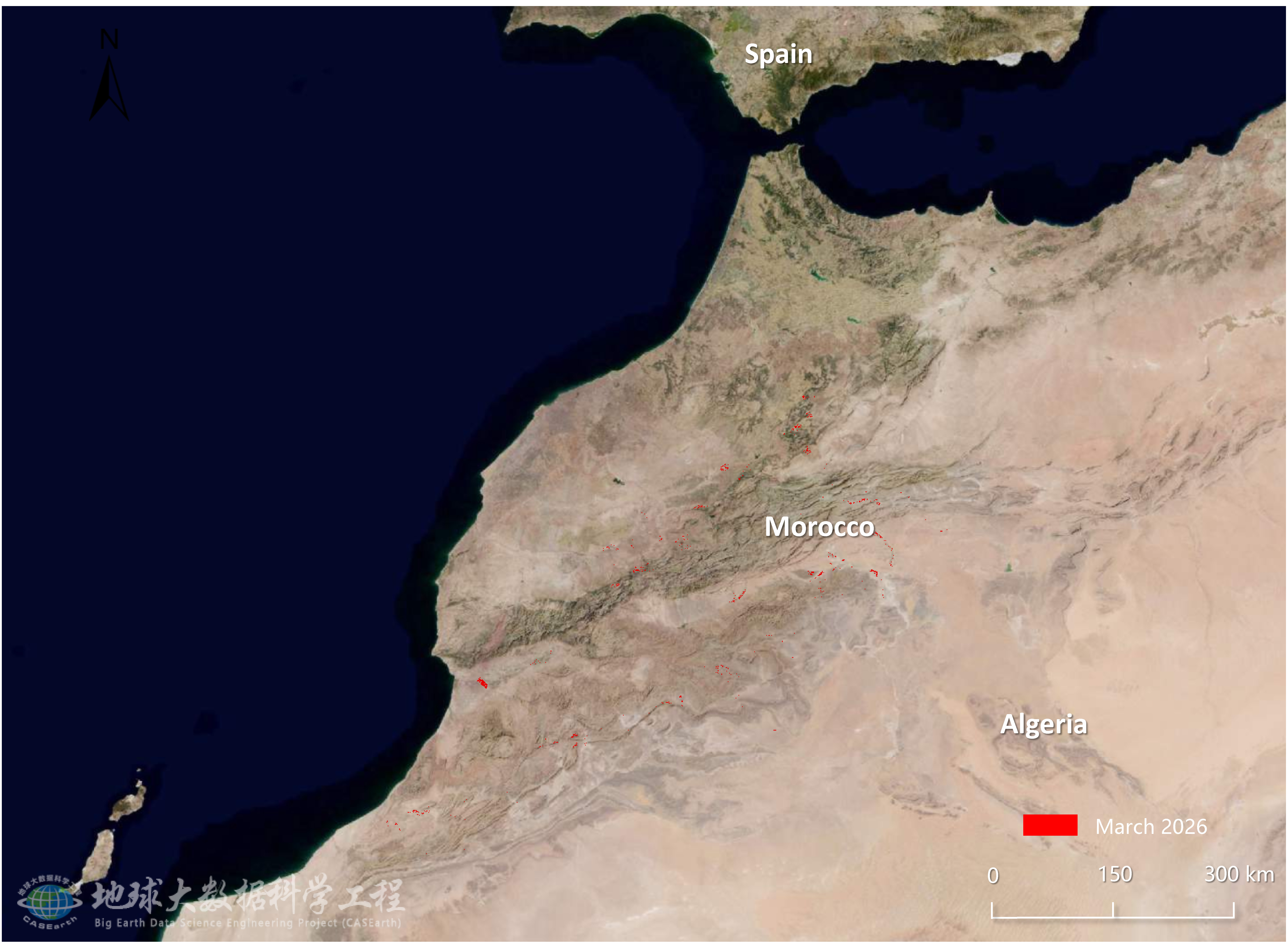
Remote sensing monitoring showed that, in March 2026, desert locusts mainly affected the central-southwestern regions of Morocco, localized northwestern areas of Algeria, and the central-northern inland areas of Saudi Arabia, affecting 64.3, 21.7, and 18.1 thousand hectares of vegetation, respectively. Morocco remained the core area of desert locust activity in North Africa. Under the influence of continued northward migration from Western Sahara and southern Morocco, together with intensified spring breeding, the affected area showed a slight increase from the previous month and extended from the southwest toward the central regions. In Algeria, affected areas were mainly located in the northwest, where limited external population input and improving spring vegetation conditions increased localized locust risk. In Saudi Arabia, damage was mainly distributed in the central-northern inland areas. Although the overall situation remained light, increased rainfall across the Arabian Peninsula and localized inland greening still provided conditions for small-scale spring breeding. Over the next two months, central-southwestern Morocco is expected to remain the key area for locust breeding and population dispersal, with localized adults possibly continuing to migrate northeastward and increasing the risk of influx into northwestern Algeria. Small-scale breeding may occur in northwestern Algeria, while Saudi Arabia is expected to remain at low-density and dispersed risk, despite possible localized breeding in the central-northern inland areas and parts of the Eastern Province. Given the crop development stages in the three countries, continued monitoring is recommended to prevent recurrent impacts on agropastoral production.

Dataset Details
Spatial Resolution:
Time Resolution:
Product Number: XDA19080304279
Create Institution: International Research Center of Big Data for Sustainable Development Goals(CBAS);Big Earth Data Center,CAS
Created By: Dong Yingying
Creation Date:
File Size: 1
Data Format: Geotiff
Type Of Data: 栅格
Data Label:
