Contact Information

Global 30-m spatial distribution of mangroves in 2000-2020 (GMF30_2000-2020)
Dataset Overview
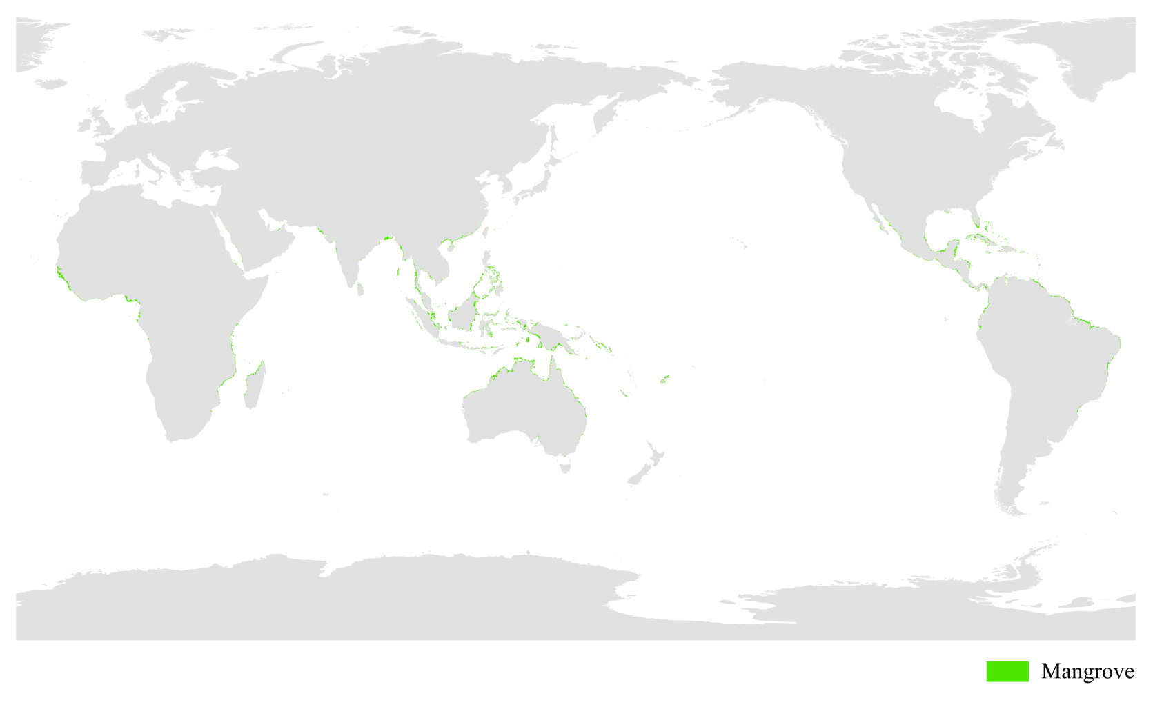
Mangrove forests are swampy, woody plant communities mainly composed of evergreen shrubs or trees distributed in the coastal wetlands of tropical and subtropical regions throughout the world. They have special sea-land characteristics and are a wetland ecosystem with important ecological, economic, and landscape values in the coastal zone. Four periods of global mangrove distribution dataset for 2000, 2010, 2015 and 2020 were generated by mapping the global mangrove change with a combination of the Capsules-Unet deep learning model and visual interpretation of imagery using multi-temporal Landsat images with no clouds or less than 20% cloud cover after pre-processing such as atmospheric correction and band combination. Compared with similar products, this product has a longer time series and can accurately reflect the dynamics of global mangrove changes. The overall accuracy of verification is greater than 88%, kappa coefficient and F1 index are greater than 0.76 and 0.88 respectively.

Dataset Details
Spatial Resolution: 30m
Time Resolution: 2000; 2010; 2015; 2020
Product Number: XDA19030302_010
Create Institution: International Research Center of Big Data for Sustainable Development Goals
Created By: Liao Jingjuan
Creation Date: 2022-08-18T16:00:00.000Z
File Size: 27
Data Format: shape
Type Of Data: Vector
Data Label:
Naming Convention
The datasets adopted the WGS84 coordinate system, latitude and longitude projection (EPSG: 4326), and Shapefile format for coordination, projection and storage respectively.
Data Citation
Jingjuan Liao. Global 30-m spatial distribution of mangroves in 2000-2020 (GMF30_2000-2020), Beijing: International Research Center of Big Data for Sustainable Development Goals (CBAS), 2022. doi: 10.12237/casearth.62ff4caa819aec75a535cbe8
Data Licence Agreement
Users of this product shall clearly indicate the source as " Global 30-m spatial distribution of mangroves in 2000-2020 (GMF30_2000- 2020)" in all forms of research output, including, but not limited to, published and unpublished papers, theses, manuscripts, books, reports, data products, and other academic output. The data producers are not responsible for any losses caused by the use of the data. The boundaries and marks used in the maps do not represent any official endorsement by or opinion of the data producers.
