Contact Information

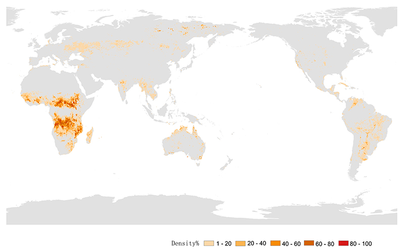
Global 30-m burned area distribution in 2020 (GBA30_2020)
Dataset Overview
Global 30-m burned area distribution in 2020 (GBA30_2020) products were generated using time series satellite data, machine learning algorithm, and cloud computing platform.

Dataset Details
Spatial Resolution: 30m
Time Resolution: 2020
Product Number: XDA19090301_001
Create Institution: International Research Center of Big Data for Sustainable Development Goals
Created By: Zhang Zhaoming
Creation Date: 2022-08-18T16:00:00.000Z
File Size: 1016
Data Format: GeoTiff
Type Of Data: Raster
Data Label:
Naming Convention
The "Global 30-m burned area distribution in 2020" product was projected in a geographic (Lat/Long) projection at 0.00025º (approximately 30 m) with the WGS84 horizontal datum and the EGM96 vertical datum. The results consist of 504 10º × 10º tiles, and each tile contains about 40,000 × 40,000 pixels. The data format is GeoTIFF. Each tile was coded according to the latitude and longitude in the upper left corner, with latitude in the front and longitude in the back. Latitude is 2 digits, with N/S as prefix; longitude is 3 digits, with E/W as prefix, where N is used at 0º latitude, and E is used at 0º longitude. Each tile file contains a layer, where the value of 1 represents the burned area, and the value of 0 represents the unburned area.
Data Citation
Zhaoming Zhang, Guojin He, Tengfei Long, Mingyue Wei. Global 30-m burned area distribution in 2020 (GBA30_2020), Beijing: International Research Center of Big Data for Sustainable Development Goals (CBAS), 2022. doi: 10.12237/casearth.62ff4d13819aec75a535cbea
Data Licence Agreement
Users of this product shall clearly indicate the source as "Global 30-m resolution burned area distribution in 2020 (GBA30_2020)" in the research output, including published or unpublished papers, thesis, reports, dataset and other academic output. Data producers are not responsible for any losses caused by the use of the data. The boundaries and marks used in the maps do not represent any official endorsement or opinion by the data producer.
