Contact Information

Vulnerability assessment data set of extreme precipitation disaster (2019)
Dataset Overview
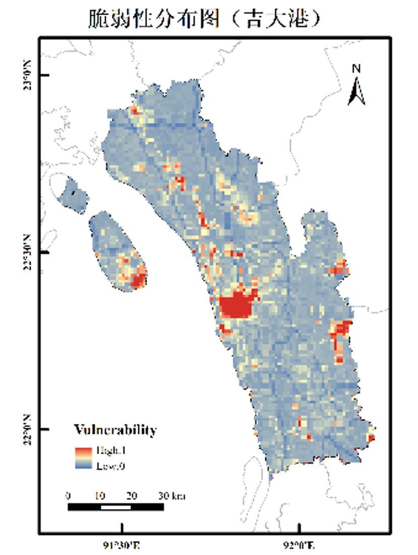
Vulnerability assessment dataset of hectometre level for 34 key nodes assessment the flood risk of key nodes in the Belt and Road under the extreme precipitation events, in order to provide basis for decision-making for the local government department, at the same time before flood disaster early warning, which may take the disaster prevention and mitigation measures for the precious time, reduce people's lives and property damage brought by the flood. Based on the data of GDP, population, land ues, road density and river density in the Belt and Road, this dataset combined with the methods of spatial analysis of ArcGIS, assigning different weights to each indicator and building assessment 34 key nodes under the condition of extreme precipitation in flood vulnerability level, which was divided into 5 levels by using natural break point method, representing no vulnerability, low vulnerability, middle vulnerability, high vulnerability, extreme high vulnerability, respectively.

Dataset Details
Spatial Resolution:
Time Resolution:
Product Number: XDA20030302_003
Create Institution: National Tibetan Plateau/Third Pole Environment Data Center
Created By: HE Yufeng
Creation Date: 2021-09-23 00:00:00
File Size: 1
Data Format: GeoTiff
Type Of Data: grid;
Data Label:
