Contact Information

Dataset of urban built-up area in China (1992-2020)
Dataset Overview
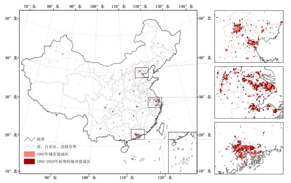
To produce this dataset, the nighttime light data, vegetation index data, and land surface temperature data were preprocessed to obtain the multi-source remote sensing data in China from 1992 to 2020, and the economic regionalization, selection of samples, support vector machine classification, and inter-annual correction were used to extract the dynamic information of urban built-up area. According to the accuracy assessment based on Landsat TM/ETM+ data, Kappa coefficient is 0.60, overall accuracy is 92.62% This dataset has been used to assess the impacts of urban expansion on natural habitats and cropland, and can provide data support for understanding China’s urban expansion and its effects. File name: The urban built-up area data is stored in the form of a grid file named "yyyy. tif", in which "yyyy" represents the year. For example, 1992. tif represents the grid file that describes China's urban built-up area in 1992. Data reading mode: users can use geographic information systems and remote sensing related software such as ESRI ArcGIS software, ERDAS software and ENVI software to read data.

Dataset Details
Spatial Resolution:
Time Resolution:
Product Number: CBAS2025RJ004
Create Institution: International Research Center of Big Data for Sustainable Development Goals(CBAS);Big Earth Data Center,CAS
Created By: He Chunyang, Liu Zhifeng, Xu Min, Lu Wenlu
Creation Date:
File Size: 1
Data Format: shp
Type Of Data: 矢量
Data Label:
