Contact Information

Global 30-m land cover dynamic monitoring product with a fine classiffcation system from 1985 to 2022 (GLC_FCS30D_1985-2022)
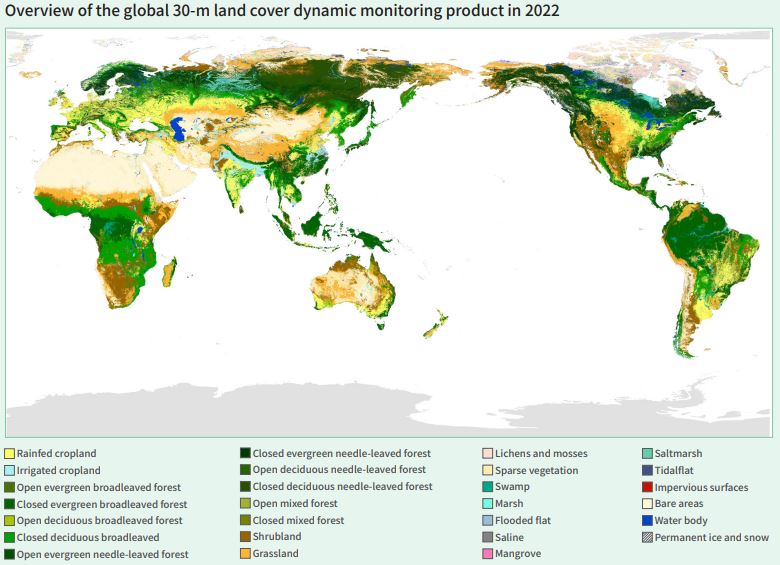
Dataset Overview
The GLC_FCS30D product is developed by a coupled full-time sequence change detection and dynamic updating strategy, which fully utilizes all available Landsat observation data to ensure the reliability of land-cover change monitoring. Specifically, the study firstly captures the spatiotemporal information of per-pixel land-cover changes using a continuous change detection model and full-time-series Landsat observations. Secondly, we jointed the change detection results with the proposed sample refinement algorithm to build a high-confidence training sample library. Further, the land cover information of these changed pixels is dynamically updated using a local adaptive classification model and multi-temporal Landsat observations. Lastly, the land cover information of the changed pixels are further improved by adopting a temporal consistency optimization algorithm (Zhang et al., 2024)。 The dataset's time range is from 1985 to 2022, with a time resolution of year, including 5-year intervals before 2000 and annual intervals after 2000.

Dataset Details
Spatial Resolution:
Time Resolution:
Product Number: CBAS-2025-data-01
Create Institution: International Research Center of Big Data for Sustainable Development Goals(CBAS);Big Earth Data Center,CAS
Created By: Liangyun Liu, Xiao Zhang
Creation Date: 2026-10-21 10:15:00
File Size: 1
Data Format: Geotiff
Type Of Data: 栅格
Data Label:
