Contact Information

Global 10m spatial distribution of mangroves in 2020 (HGMF_10m_2020)
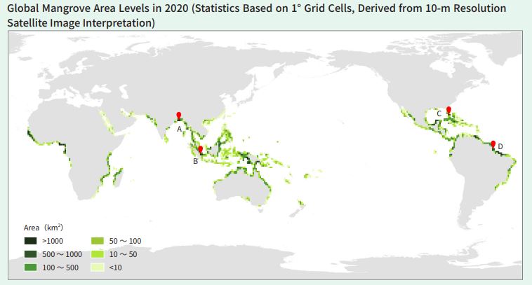
Dataset Overview
The product was developed using dense time-series remote sensing data and an object-oriented machine learning approach, enabling comprehensive identification and extraction of mangrove forests at the global scale. To define the study area's spatial extent, publicly available global mangrove datasets with varying temporal and spatial resolutions, such as the Global Mangrove Watch, were integrated to delineate core mangrove distribution zones.A 5 km buffer was applied to account for intertidal regions and transitional ecosystems. By leveraging the high revisit frequency of Sentinel-2 imagery, a high-precision and robust automated compositing method was developed to generate cloud-free, low-tide composite images for tropical and subtropical coastal regions. Using object-oriented image analysis and a random forest classifier, the spatial extent of mangrove patches was identified, resulting in the 2020 global mangrove spatial distribution product at 10 m resolution. The extracted mangrove patches display complete spatial morphology and clearly defined boundaries, including ecological and geographical features such as tidal creeks and canopy gaps.

Dataset Details
Spatial Resolution:
Time Resolution:
Product Number: CBAS-2025-data-04
Create Institution: International Research Center of Big Data for Sustainable Development Goals(CBAS);Big Earth Data Center,CAS
Created By: Mingming Jia
Creation Date: 2026-10-20 09:17:20
File Size: 1
Data Format:
Type Of Data: 栅格
Data Label:
