Contact Information

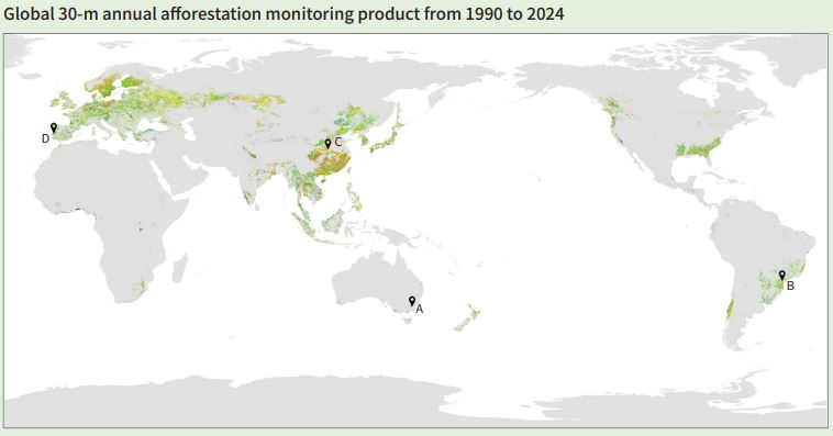
Global 30-m annual afforestation monitoring product from 1990 to 2024 (GAAM_30m_1990-2024)
Dataset Overview
This data product is developed from multi-source remote sensing data using time-series analysis methods. The data sources include Landsat satellite imagery and the Spatial Database of Planted Trees Version 2.0 (SDPT V2) from the World Resources Institute (WRI) (Richter et al, 2024). First, potential global afforestation areas were delineated by integrating the spatial extent of planted forests in WRI's SDPT V2 and conducting trend break analysis of vegetation index time series. Second, Landsat imagery acquired during the tree growing season each year from 1990 to 2024 was selected to calculate the annual maximum Normalized Burn Ratio (NBR). Due to gaps in Landsat observations across certain years and regions, a sliding window strategy was applied to fill missing values, and the Whittaker Smoothing algorithm was used to denoise the NBR time series, resulting in a continuous and smooth annual NBR trajectory. Finally, the LandTrendr algorithm was employed to automatically fit and segment the NBR time series, enabling the extraction of global afforestation years via temporal breakpoint detection with prior knowledge.

Dataset Details
Spatial Resolution:
Time Resolution:
Product Number: CBAS-2025-data-05
Create Institution: International Research Center of Big Data for Sustainable Development Goals(CBAS);Big Earth Data Center,CAS
Created By: Zhenrong Du, Le Yu
Creation Date: 2026-10-20 09:14:16
File Size: 1
Data Format: Geotiff
Type Of Data: 栅格
Data Label:
