Contact Information

Global 30-m marine raft aquaculture data product in 2010, 2020, and 2024 (GOFAR_30m_2010/2020/2024)
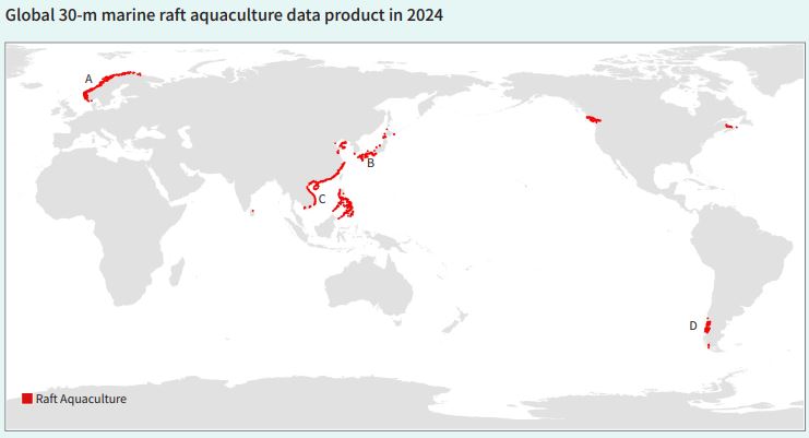
Dataset Overview
This product is a high spatio-temporal resolution dynamic monitoring product developed from multi-source satellite remote sensing data. By fusing the spectral, textural, and geometric features of time-series optical and radar imagery and combining deep learning algorithms, it enables the precise extraction of the maximum distribution of raft aquaculture facilities, including cages. The product uses a WaveNet model based on residual connections and an encoder-decoder architecture, combined with multi-temporal optical and SAR satellite imagery to extract raft aquaculture areas. The model integrates feature aggregation and dispersion modules, which not only reduce model complexity and parameter count but also significantly enhance feature representation. This method avoids the tedious process of building large-scale sample libraries and achieves higher segmentation and recognition accuracy even with limited samples. However, due to seasonal changes, water vapor conditions, and sea states, single-temporal imagery often fails to fully capture all aquaculture areas. Therefore, results from different temporal optical and SAR imagery are fused, then sorted, standardized, and revised.

Dataset Details
Spatial Resolution:
Time Resolution:
Product Number: CBAS-2025-data-06
Create Institution: International Research Center of Big Data for Sustainable Development Goals(CBAS);Big Earth Data Center,CAS
Created By: Chengyi Wang
Creation Date: 2026-10-20 09:11:32
File Size: 1
Data Format: shp
Type Of Data: 矢量
Data Label:
