Contact Information

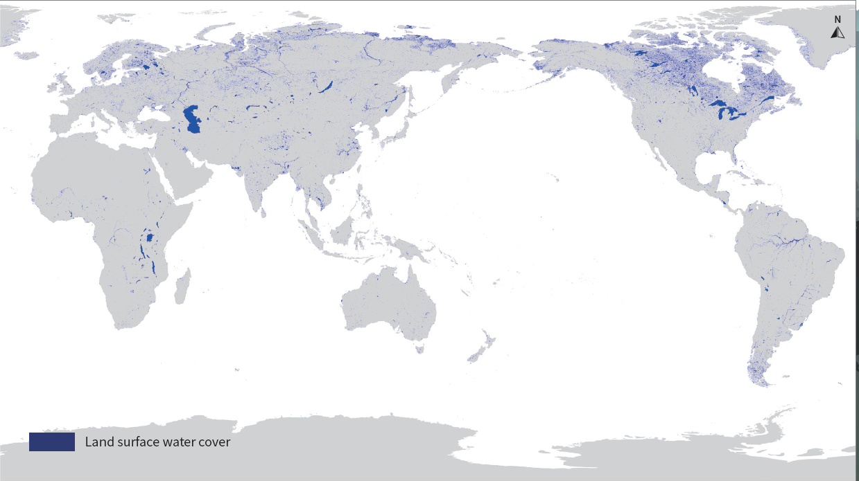
Global 30-m annual maximum land surface water cover in 2000, 2005, 2010, 2015, 2021 (GAMLSW30)
Dataset Overview
Global annual maximum land surface water cover refers to the maximum distribution of all types of water present on the land surface, derived from all available Landsat satellite data within the year. The distribution of global land surface water cover is strongly influenced by global change, and its changes have important implications for biodiversity and the health of water-related ecosystems. The production method is to apply the remote-sensing feature indices threshold rules based on prior knowledge to extract land surface water information from multi-temporal Landsat data of the same area within a year and integrate the results into the global annual maximum land surface water cover product.

Dataset Details
Spatial Resolution: 30m
Time Resolution: Annual
Product Number: XDA19090301_003
Create Institution: International Research Center of Big Data for Sustainable Development Goals
Created By: Huichan Liu, Guojin He, Ranyu Yin, Yan Peng, Guizhou Wang
Creation Date: 2023-03-22T05:41:16.677Z
File Size: 5
Data Format: GeoTiff
Type Of Data: grid
Data Label:
Naming Convention
Paper Citation
Data Citation
