Contact Information

Global 8-day/250-m surface water extent dynamics from 2000 to 2020 (GSWED250_2000-2020)
Dataset Overview
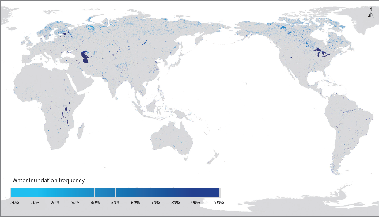
This product is designed to monitor the open surface water (called " surface water ") where the land surface is not blocked by vegetation and not frozen, including all types of water bodies such as rivers with a width greater than 250 meters and lakes and reservoirs with a surface area greater than 0.0625 Square kilometers. With the high temporal resolution (8-day), this product can be used to accurately reflect changes in the distribution of surface water over time (called “water dynamics“). The product was generated based on the remote sensing vegetation index threshold method, in combination with multi-source remote sensing data (Han & Niu, 2020). The source data used to generate the product include MODIS-related data (MOD44W, MOD09Q1, MOD09A1, MOD13Q1, and MOD11A2) and topographic data (SRTM and GTOPO30).The GSWED was validated by using 8687 spatially and temporally random water samples, with an overall accuracy of 96%. Land surface water dynamics is one of the most important indicators of changes in water resources. Accurate determination of land surface water dynamics is important for understanding the characteristics of the Earth system water cycle and its response to climate change and human activities. Such data products have important application values for water resources management.

Dataset Details
Spatial Resolution: 250 m
Time Resolution: 8-day
Product Number: XDA19090120_030
Create Institution: International Research Center of Big Data for Sustainable Development Goals
Created By: Qianqian Han; Zhenguo Niu
Creation Date: 2023-03-22T05:41:16.774Z
File Size: 42
Data Format: GeoTiff
Type Of Data: grid
Data Label:
