Building Map of Chenzhou and Guilin Central Urban Areas (2015\2020\2024)
Multi-temporal Vector Road Data Product of Chenzhou's Main Urban Area Based on High-Resolution Imagery (2010, 2015, 2020,2024)
Land-cover products within the core urban areas of Chenzhou, Hunan in 2015, 2020 and 2024
Road network dataset of Chenzhou City and Guilin City from 2022 to 2024
2015年城市规划空间化数据集(建成区面积、规划区面积)
2020年中国地级以上城市优于2米分辨率建成区产品数据集
2015年中国地级以上城市优于2米分辨率建成区产品数据集
2018年中国城市规划空间化数据集(建成区面积、规划区面积)
SDG11.7.1城市建成区公共空间面积指标评价数据集(2018年)
2017年中国城市规划空间化数据集(建成区面积、规划区面积)
2020年中国各城市建成区数据
Dataset of urban built-up area in China (1992-2020)
Satellite remote sensing data
Drone Tilt-photography Data
Impervious Surface Data
Contact Information

Land-cover products within the core urban areas of Chenzhou, Hunan in 2015, 2020 and 2024
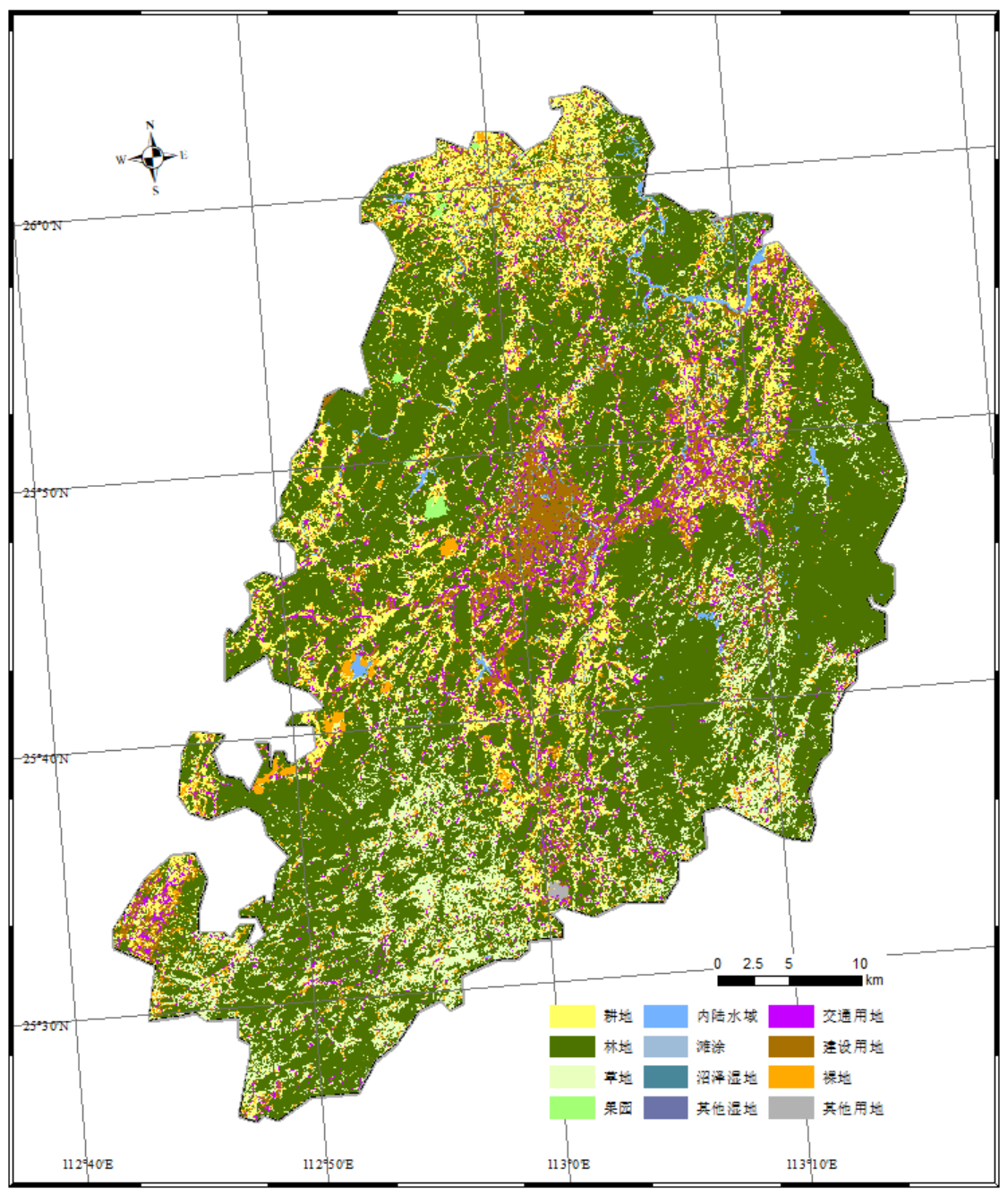
Dataset Overview
Based on time-series remote sensing imagery, key phenological periods are selected to construct an optimized classification algorithm integrating composite features such as spectral signatures, texture, and topography for accurate identification and extraction of land cover types.

Dataset Details
Spatial Resolution:
Time Resolution:
Product Number: CBAS2026-SJGX-015
Create Institution: International Research Center of Big Data for Sustainable Development Goals(CBAS);Big Earth Data Center,CAS
Created By: Haiying Zhang
Creation Date: 2026-02-04 10:34:08
File Size: 1
Data Format:
Type Of Data: 矢量
Data Label:
