Geo Crop Production Data for Africa from 2010 to 2020 (GeoCropProd_Africa_10km_2010-2020)
Dataset Overview

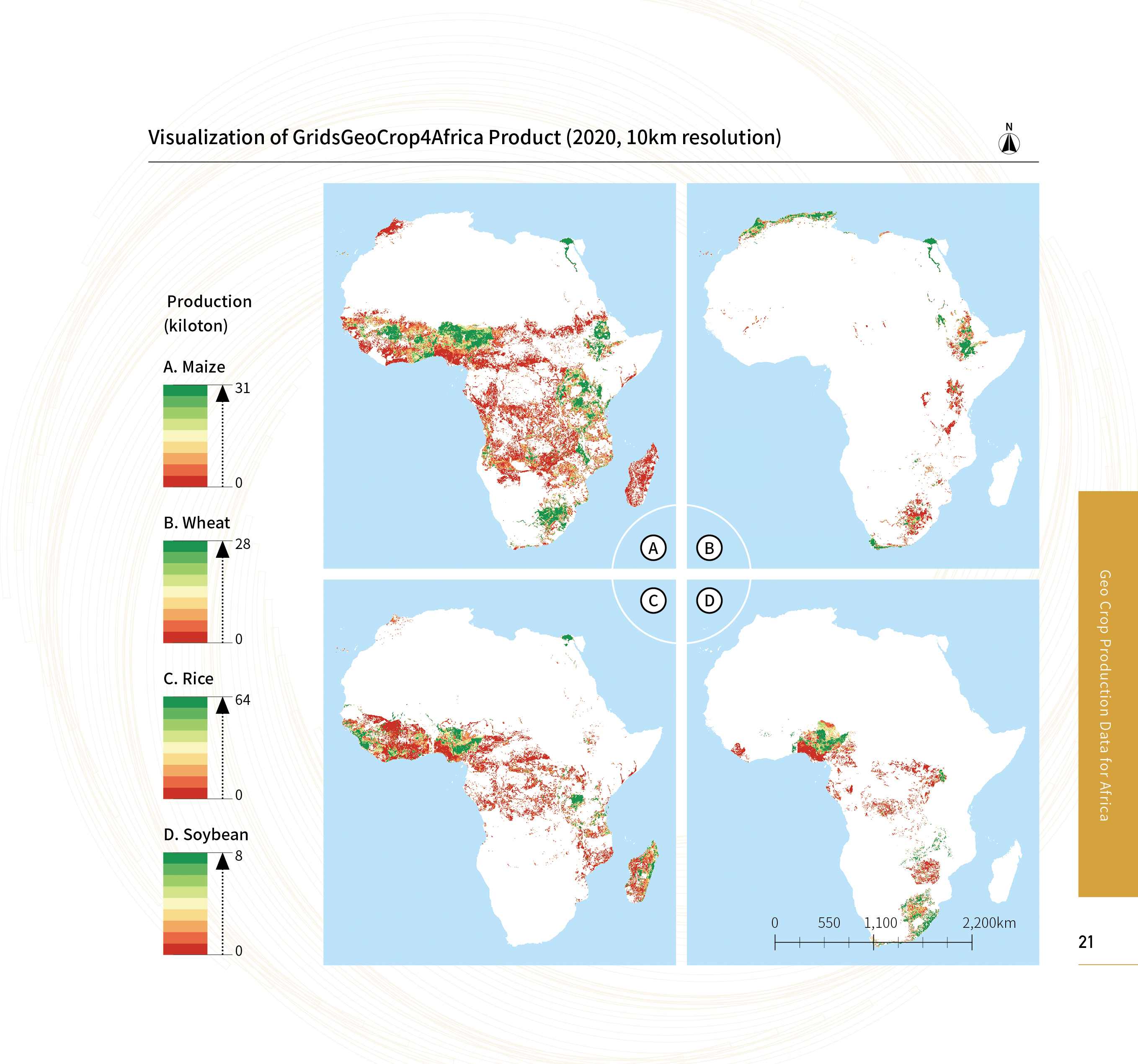
This data product presents the production of four major crops: maize, wheat, rice and soybean, in a geographical grid format. Quantifying the spatial distribution and trends in food production, and identifying the key factors limiting increased food production, are essential for taking effective action to increase food production and achieve food security in Africa. This data product comprehensively shows the spatiotemporal distribution pattern of major crop production in Africa, reflecting the synthesis of various elements such as regional land productivity, crop growth conditions and agricultural management efficiency. It contributes to the analysis of the driving mechanisms behind changes in crop production, providing valuable guidance for the growth of food production and sustainable agricultural development in Africa, and promoting the achievement of the SDG2 goal of zero hunger. This data product shows the production of four major crops: maize, wheat, rice, and soybean, presented in a geographical grid format.

Spatial Resolution:

Time Resolution:

Product Number: XDA19090201_010

Create Institution: ext_enOrganizationName

Created By: Hongwei Zeng; Xingli Qin; Bingfang WU

Creation Date: 2024-09-27 14:16:59

File Size: 1

Data Format: Tiff

Type Of Data: grid;

Data Label:

Naming Convention

file format. Each crop per year is represented as a single band image, with pixel values corresponding to the crop production data in kilotons (kt) for that spatial grid.

Paper Citation

Bingfang Wu, Miao Zhang, Hongwei Zeng, et.al.2023. Challenges and opportunities in remote sensing-based crop monitoring: A review.National Science Review, 10(4). https://doi.org/10.1093/nsr/nwac290.
Bingfang Wu, Fuyou Tian, Mohsen Nabil, et.al. 2023. Mapping global maximum irrigation extent at 30m resolution using the irrigation performances under drought stress. Global Environmental Change, 79:102652. https://doi.org/10.1016/ j.gloenvcha.2023.102652.
Danielle Grogan, Steve Frolking, Dominik Wisser, et al. 2022. Global gridded crop harvested area, production, yield, and monthly physical area data circa 2015. Sci Data, 9(15). https://doi.org/10.1038/s41597-021-01115-2.

Data Citation

Hongwei Zeng, Xingli Qin, Bingfang Wu. Geo crop production data for Africa from 2010 to 2020 (GeoCropProd_Africa_10km_2010-2020), Beijing: International Research Center of Big Data for Sustainable Development Goals (CBAS), 2023. DOI:10.12237/casearth.64e014fd819aec27a589e7a7.

Data Licence Agreement

Users of this data product shall clearly indicate the source and the authors of "Geo crop production data for Africa from 2010 to 2020 (GeoCropProd_Africa_10km_2010-2020)" in all forms of their research output (including, but not limited to, published and unpublished papers/reports, theses, monographs, data products, and other academic output) generated by using this data product, and shall cite the corresponding references. The data producers shall not be liable for any loss arising from the use of this data product. The boundaries and masks used in the maps do not represent an official opinion or endorsement by the data producers.