
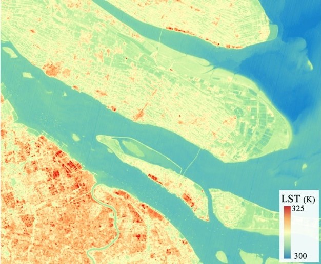
Landsat 8 Land Surface Temperature product
Landsat 8 Land Surface Temperature (LST) products are released on CASEarth Databank platform by Aerospace Information Research Institute, Chinese Academy of Sciences. LST products are generated by the AirLST retrieval procedure and the Landsat 8 images received by the remote sensing satellite ground station of China. This program utilizes the generalized single channel algorithm combined with MODIS atmospheric water vapor content product to obtain land surface temperature. For detailed information on the Landsat 8 land surface temperature product, please refer to the Landsat 8 land surface reflectance/land surface temperature product manual.
(1)
Temporal coverage of the product
Basically
consistent with the Landsat-8 data received and archived by remote sensing
satellite ground station of China, from April 2013 to present. However, for
Landsat 8 data with missing thermal infrared bands, land surface temperature
inversion cannot be performed.
(2)
The Landsat 8 land surface temperature product inherits all the features of the
Landsat 8 ortho-rectified product, including sensors, band information, central
wavelength, spatial resolution, geometric correction method, and geometric
correction accuracy. Please refer to the parameter introduction of Landsat 8 on
the USGS website
for details.
(3)
The geometric accuracy of the Landsat 8 land surface temperature product
inherits the geometric accuracy of the Landsat 8 ortho-rectified product, which
is consistent with the geometric accuracy of the
Landsat 8 Collection 2 Level-1 data released
by USGS. Radiometric accuracy of the Landsat 8 land surface temperature
products was provided in detail in the Landsat 8 Land Surface Reflectance /Land
Surface Temperature Product Manual
(4) Landsat 8 land surface
temperature products can be freely downloaded from the CASEarth
Databank platform.

