Contact Information

Global 1-km cropland water-use efficiency from 2001 to 2020 (GCWUE-1km_2001-2020)
Dataset Overview
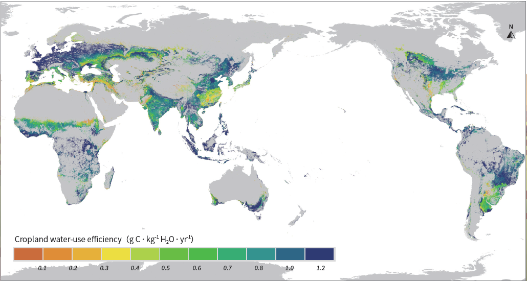
The cropland water-use efficiency (WUE) is critical to human well-being and sustainable development goals, among other things. With limited water resources and increasing water demand, improving cropland WUE to reduce water consumption per unit of productivity is a critical way to mitigate global water scarcity. WUE characterizes the trade-off between photosynthetic carbon assimilation and water use, and reflects the capacity of cropland to provide ecosystem services. The cropland water-use efficiency (WUE) defined in this product refers to the ratio between Net Primary Productivity (NPP) and Evapotranspiration (ET) of croplands (unit: g C⋅kg-1 H2O⋅yr-1). The cropland ET was derived from the “Global daily 1-km actual evapotranspiration from 2000 to 2021” dataset generated by the ETMonitor model using multi-source remote sensing data. Cropland NPP is equal to the Gross Primary Productivity (GPP) minus the fraction of the stored organic carbon consumed by crops to maintain crop respiration (CR). GPP was estimated using an improved Light Use Efficiency model (EF-LUE), accounting for the soil water stress. CR was obtained by summing the growth respiration (proportional to NPP) and maintenance respiration (related to Leaf Area Index, etc.). Input data for the NPP estimation include (1) the Fraction of Photosynthetically Active Radiation (fPAR) and Leaf Area Index data from the Global LAnd Surface Satellite (GLASS) product, and (2) the downward shortwave radiation, air temperature and dew-point temperature provided by the ERA5 global reanalysis dataset. The global distribution of cropland (including pure cropland pixels and cropland/natural vegetation mosaic pixels) was obtained from the European Space Agency Climate Change Initiative (ESA-CCI) land cover/use classification data. This product uses the WGS84 coordinate system with latitude and longitude projection (EPSG: 4326). Data are stored in GeoTIFF format. Each file contains one data layer (band) of annual cropland water-use efficiency over croplands of the globe.

Dataset Details
Spatial Resolution: 1km
Time Resolution: Annual
Product Number: XDA19030203_007
Create Institution: International Research Center of Big Data for Sustainable Development Goals
Created By: Min Jiang, Chaolei Zheng, Li Jia
Creation Date: 2023-03-22T05:41:16.760Z
File Size: 20
Data Format: Geotiif
Type Of Data: grid
Data Label:
Naming Convention
Paper Citation
Data Citation
