Contact Information

High precision population spatial distribution datasets in China for 1935, 1953, 1964, 1982, 1990, 2000, 2010, and 2020
Dataset Overview
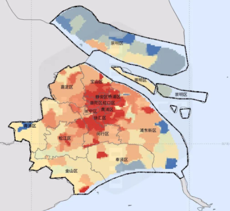
Population data at the 30m grid resolution was generated by fitting against building data, land use data, and census data (at the neighborhood committee level). A comparison between this 30m-resolution population grid data and those from GPW (Gridded Population of the World), GHSL (Global Human Settlement Layer), and WorldPop revealed that the results of this study provide a more detailed and accurate representation of the urban population distribution within the inner area of Shanghai .

Dataset Details
Spatial Resolution:
Time Resolution:
Product Number: CBAS-2025-ECNU-03
Create Institution: International Research Center of Big Data for Sustainable Development Goals(CBAS);Big Earth Data Center,CAS
Created By: Yuan Lina
Creation Date: 2025-09-17 11:20:23
File Size: 1
Data Format: Geotiff
Type Of Data: 栅格
Data Label:
